Follow up to Drones and Horses are a Good Combination.
In Part 1 of Drones and Horses are a Good Combination we established a baseline of the pasture health in late spring. Now that the summer growing season is almost half over, we want to know if there are any changes in the health of the pastures. In July we re-flew and re-evaluated the pastures using the same flight plan for the drone.
Actions taken after the May 2020 Drone Pasture Health Flight
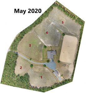
Using the drone information from the May flight, a plan was put into place to help improve the pastures.
- Fertilizing all 5 pastures
- Spraying a broadleaf weed herbicide
- Pasture rotation plan developed
Rotation Plan
After May’s drone flight, the farm developed a pasture rotation plan. While all the pastures looked bad in May, pastures #4 & #5 had the least amount of grass. The farm has four horses and uses two pastures at a time. Pasture #2, the smallest in size, was completely rested and not used. For pasture #3, a single older horse was turned-out without rotation. In May, pasture #3 was in the best condition, and since just one horse was grazing on it, the grass had the greatest chance of recovery without resting. Pastures #1, #4, #5 were used in rotation for the three other horses. Pasture #1 was used lightly for only a few nights, before removing the horses in an effort to prevent overgrazing. Pastures #4 and #5 are sacrifice fields and a pass-through gate between them was open to provide a larger turnout area for the horses, further helping to reduce the chance of overgrazing. In scenarios where too many horses are on a small number of acreages, a sacrifice field is useful to allow other pastures time to recover. This helps prevent damage to the resting field’s root system during dry periods or when the grass is stressed. In the short run, the sacrifice field may struggle, but the rested fields will become more productive and provide better forage.
The Results
Comparing data helps to track change
Comparing data is one benefit to using drones for pasture management. Comparative data enables you to easily determine if your pastures are improving, maintaining health, or deteriorating. The data will help guide your decisions, such as fertilizing, reseeding, or letting a pasture rest. Using the drone, the farm re-flew the pastures in early July 2020, approximately six weeks after the May flight.
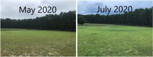
At ground level we can see a slight improvement between May and July. Most noticeably is the grass in July grew, filling in some of the bare patches visible in the May photo.
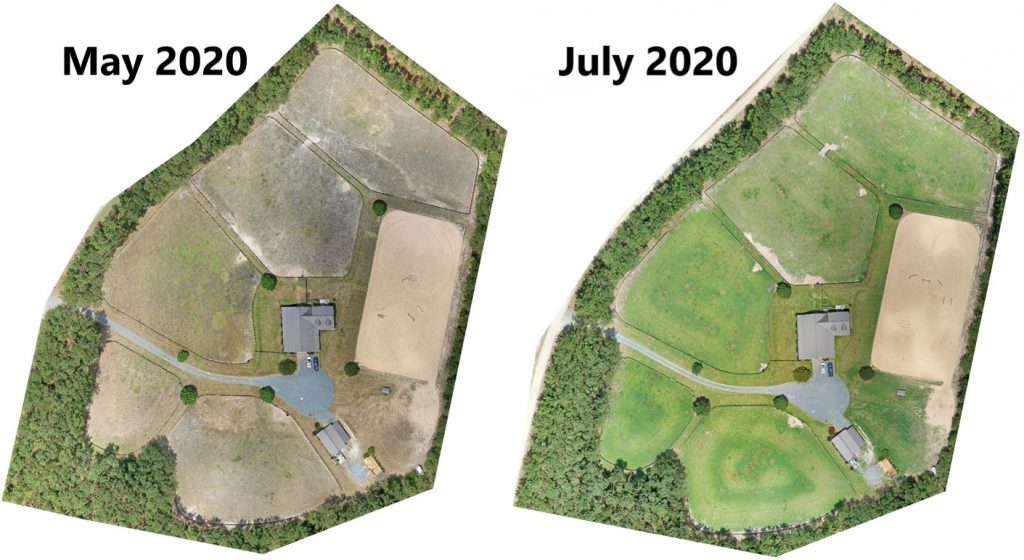
The improvement in the grass is obvious from the aerial view, created by stitching over 100 individual drone images to provide a single map view of the property.
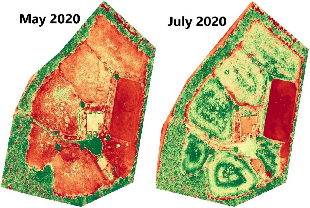
Using the plant health filters, the improvements between May and July become more obvious. In May, on the left, all the pastures showed red (poor). By July, the fields now show mostly green (healthy) to yellow (moderate).
Quality Control/Vendor Management
Pasture rotation and fertilization had a positive impact. The fertilizing was contracted to a farm maintenance company. With any contracted work it can be difficult to verify you are getting the full value for your dollar. One problem that you can clearly see from the aerial perspective, especially on the above plant health map, is the circular swirls of green. This is the result of uneven distribution of fertilizer. As an extra benefit to a drone flight, you can verify the quality of work. In this case, the farm can contact the vendor, send them the drone imagery of the uneven distribution, and hopefully come to a resolution. In a case of self-application, you can use the information from the drone to adjust your technique and maximize the benefit of fertilizing.
Impact of knowing the health of your pasture
Typically, this farm would do 2 applications of fertilizer during the summer for all pastures. As a result of the drone information, the farm will now skip the second application, saving both time and money. Additionally, changes in pasture rotation is preventing over grazing and improving grass growth in all fields. With this improvement there is no need to provide hay to the horses while in the pasture, helping to reduce the amount of hay purchased. In this case, the farm uses approximately 60-70 bales (2-tons) of hay a month during the winter and early spring. This summer they are averaging less than a bale of hay a day, lowering the cost of horse ownership.
To learn how drone imaging can benefit you, please go to www.heightsight.com or checkout the Height Sight Facebook page.
About the Author
 Paul Rose is a partner with Height Sight LLC, a drone imaging company, and a FAA Part 107 certified drone pilot. As a junior and amateur, he competed at USEF rated horse shows in hunters and jumpers. Currently, he lives on a small farm in Moore County NC with his wife and four horses. Paul likes finding ways to combine his work in drone technology and passion for horses to help improve people’s property and the living conditions for all horses.
